
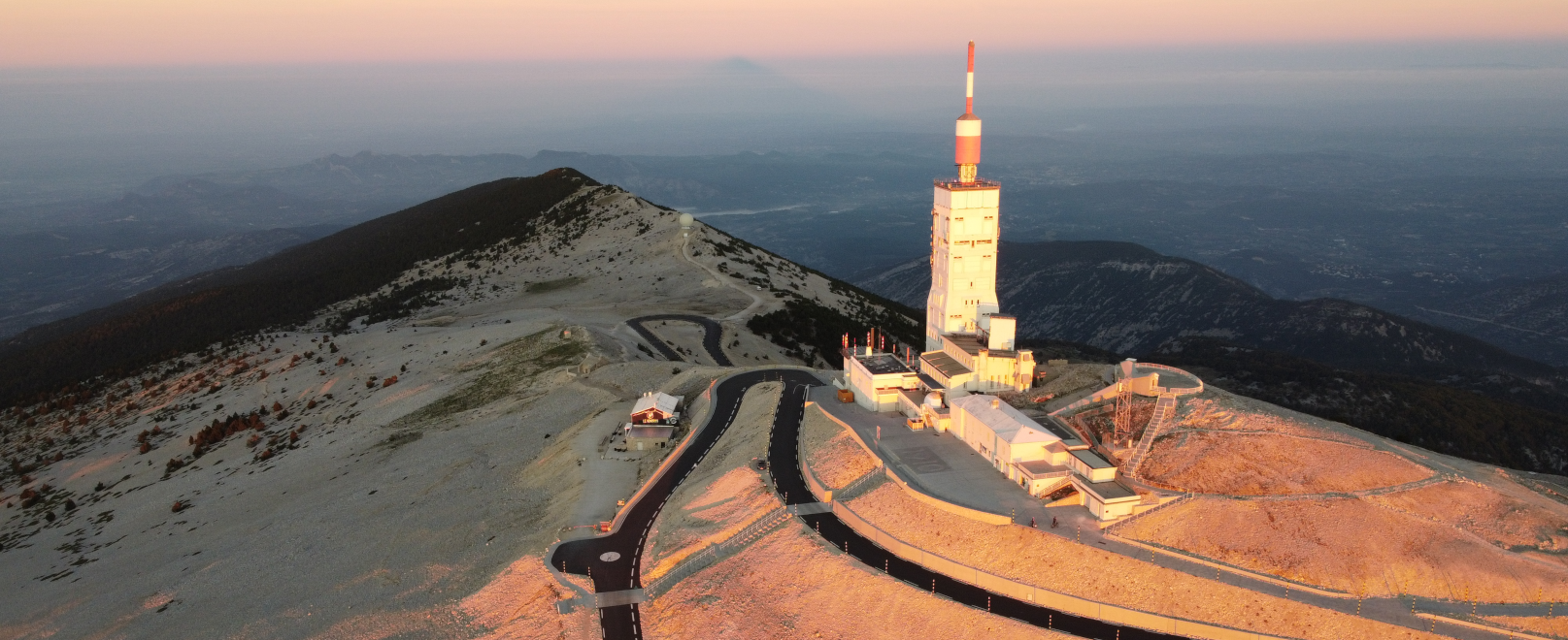
After two years of work, the Ventoux summit has finished its facelift: pedestrians and cyclists benefit from the new esplanade, the car park has been reorganised further down, and a natural environment has been restored.
The works
If the mountain creates an impression, standing in the middle of the Comtat plain constantly wearing a white crown, the memory of the summit you might have was often that it was a mess. Cars were parked all over the place along the roads, unauthorised pedestrian paths ran across the screes and cyclist, hikers, cars and camping cars all clashed with each other. The situation was affecting the ecosystems and made the visitor experience not one to remember.
Two years of works have enabled the mythical summit to be organised better. The task was complicated: land with several different owners, a hundred ecological protection layers in place (Natura 2000 zone, Biosphere Reserve, Regional Nature Park, biotope protection orders…), weather that can be hostile, with snow-laden winters and Mistral gusts up to 190km to deal with. But the result reflects the human and financial investment!

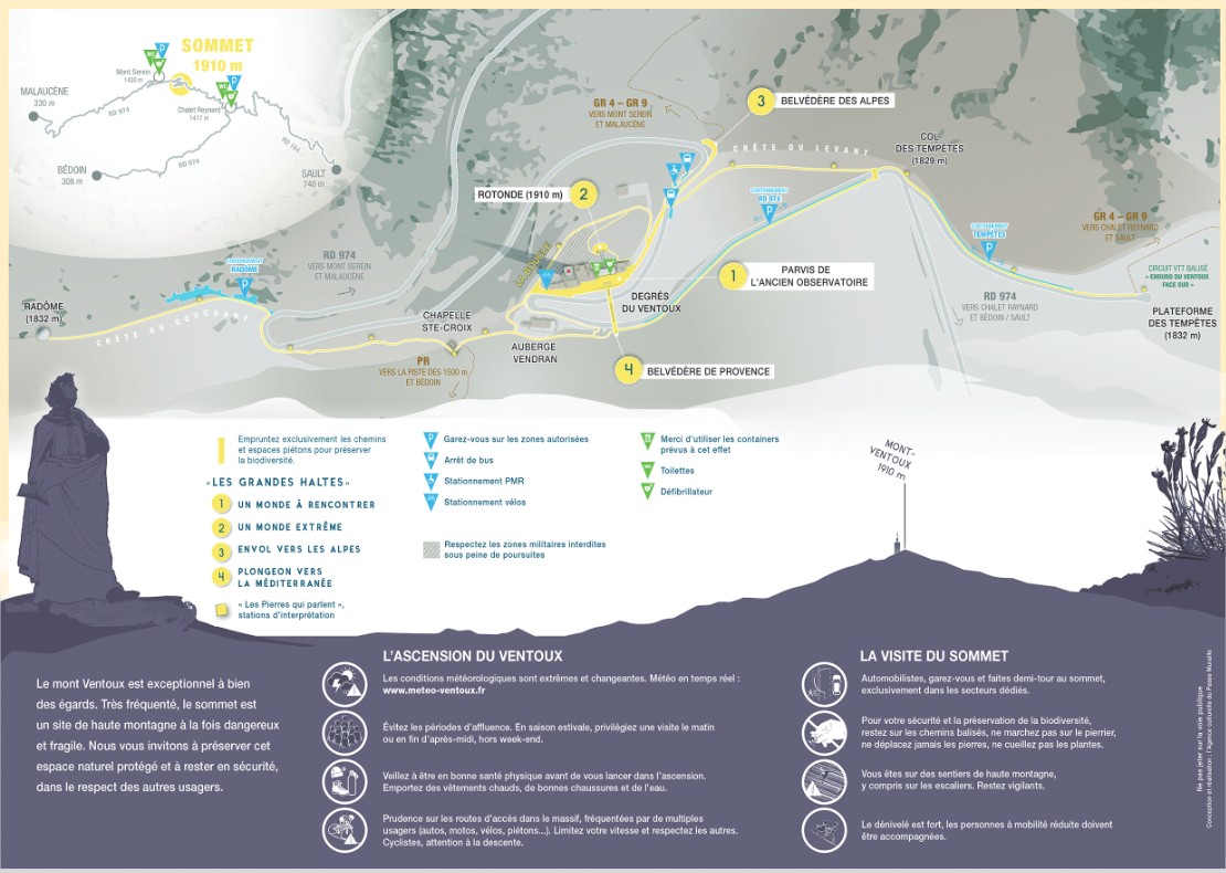
A useful little map
A pocket-sized map gives you all the information you need in 4 languages (F/EN/D/NL),. Please feel free to ask us for one in the language you would like, lise.collin@parcduventoux.fr.
An esplanade freed-up for cyclists and pedestrians

Good to know
The “Affluences” map indicates in real time the number of parking spaces available at the top.
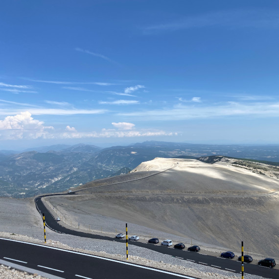
The aim was to return the space to pedestrians and cyclists. The free parking spaces are clearly indicated before getting to the summit: at the col des Tempêtes (on the road between Bedoin and the summit), at Le Radôme (on the road from Malaucène to the summit), and spaces marked along the RD 974.
However cars and coaches can still turn around at the summit.
From these parking spaces, you reach the summit on foot in ten or so minutes, albeit with a climb involved (80m or more).
Good to know:
A PRM (persons with reduced mobility) parking area has been created above the Belvédère des Alpes.
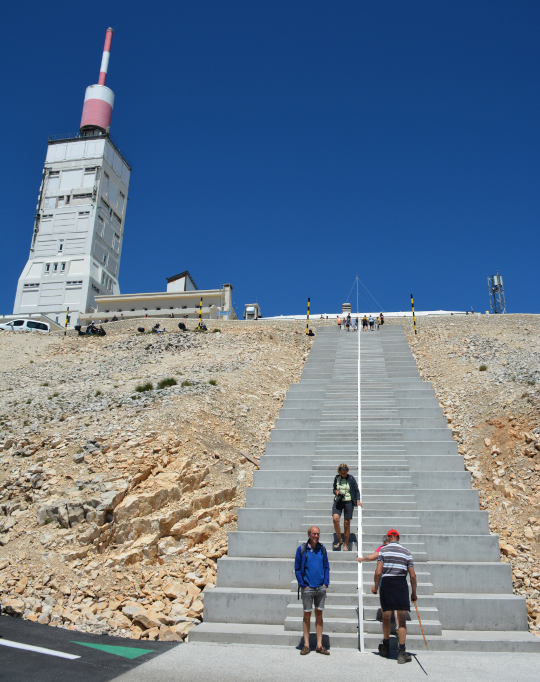
New steps, panoramic viewpoints
A new set of imposing grey concrete steps forms the stunning architectural aspect of the new organisation, which has really changed the look of the summit. It enables the paths pedestrians took to be contained, as they tended to be scattered among the screes.
As an aside, it forms the perfect podium for the arrival of future Ventoux stages of the Tour de France!
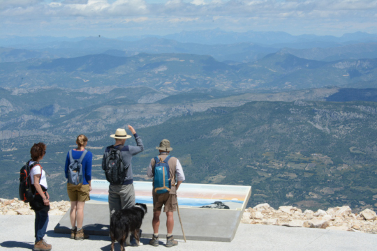
It partly links the Belvédère de Provence, which provides a wide view towards Provence in the direction of the Mediterranean, and the Belvédère des Alpes, one of the most beautiful panoramas of the region towards the mountains, to the north.
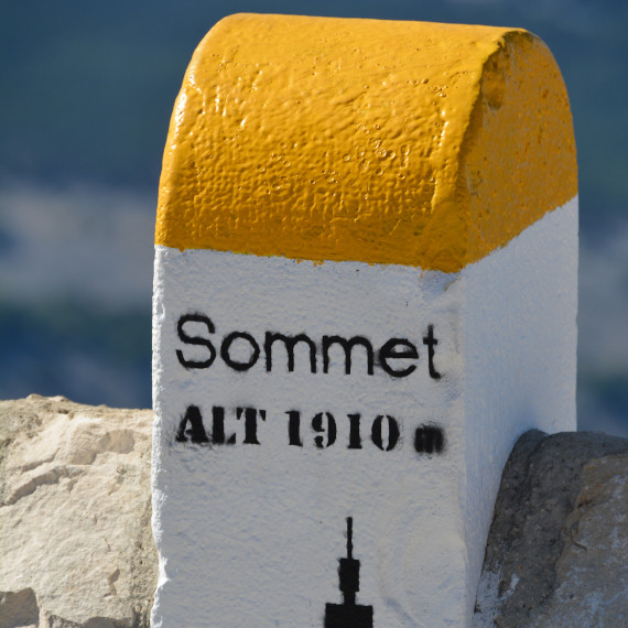
Between the two, you can wander, alongside the cyclists, on the esplanade where the old weather observatory still stands. The height of Mont Ventoux can now be seen from above, written on the ground in large numbers: 1910.

Did you know ?
1910 : this is the new final official height of Mont Ventoux, given in 2020 by the also very official IGN organisation
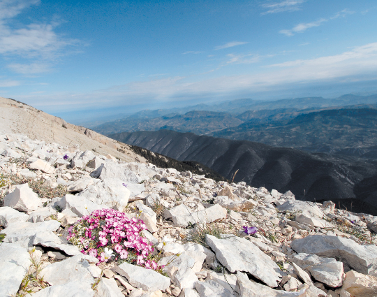
Protected biodiversity

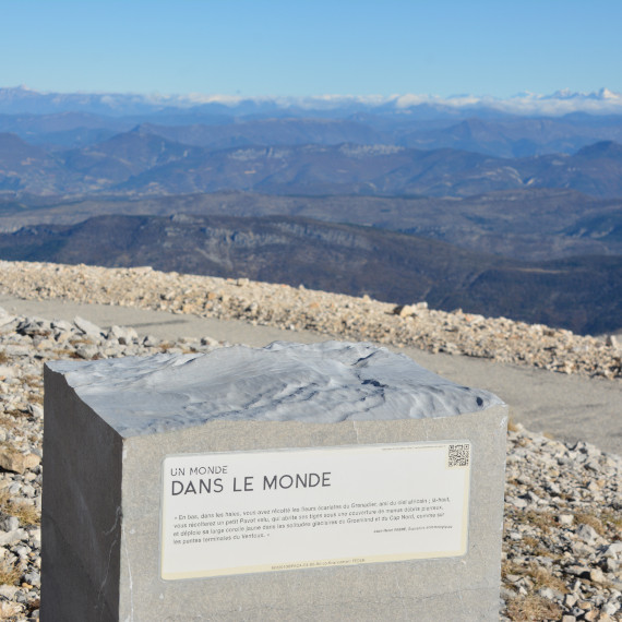
“Stones that talk”
Stopping points have been designed all along the circuits to provide information about Mont Ventoux and its environment using QR codes.
It is hard to imagine the lengths taken to preserve the biodiversity: each stone has been restored to its place as they provide protection, here a bird nesting, there exceptional flora. Eco-guards now roam the space in season and make sure that the screes are respected, and not allowing cairns to be built for example.
Copyrights : ©Parc Naturel régional du Mont Ventoux, Sols, VPA